Raytheon Wins $600 million US Contract from National Geospatial Intelligence Agency

Raytheon has been awarded two contracts worth US$600 million from the National Geospatial Intelligence Agency to develop data automation, analytics and artificial intelligence capabilities for the NGA Janus program.
The contracts go toward the Elevation Content and Precise Imagery programs, which are part of NGA's Janus initiative to give greater interchangeability between agency partners with access to NGA data and imagery.
"Our advanced analytics, automation and AI will keep NGA capabilities on the cutting edge," Raytheon IIS president Dave Wajsgras said in a statement.
"The solutions provided by NGA to the broader user community will offer higher quality and faster delivery of mission critical information," Wajsgras said.

Leonardo’s Geospatial Maritime Security Platform Launched At Farnborough

DARPA Eyes Cloud-based Repository to Harness Geospatial Imagery for Defense Analyses

BAE Systems To Provide Geospatial Intelligence Support To US Army For $75

Harris Corp Wins $770 Million Geospatial Data Mapping Contract
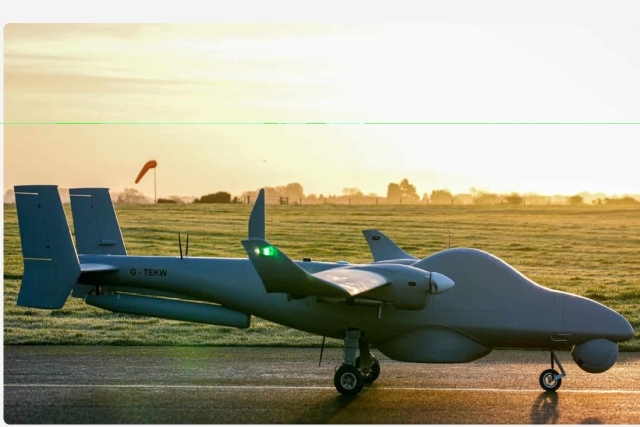
U.K. Army to Induct Ukraine-tested Tekever Reconnaissance Drones
Want Civil Nuclear Deal? Sign Abraham Accords First, Trump Tells Saudi Arabia

Ukraine Unveils MUL.E Electric-Hybrid Combat Motorcycle

Mass Production of Russian MC-21 Airliner Gains Momentum- 18 Aircraft Currently on...

One Month Since U.S., Israeli War Against Iran: Who Is Gaining?
One month after the United States and Israel launched coordinated strikes on Iran on February 28 the conflict has expanded...

Modern Tank Showdown: T-90MS, Leopard 2A7, M1E3 Abrams Compared
Main Battle Tanks (MBTs) have shown their mettle in recent conflicts such as in Ukraine despite being increasingly vulnerable to...
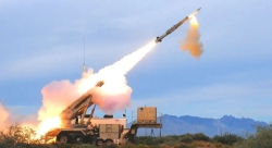
European Nations Prioritizing Europe-made IRIS-T & SAMP-T over American Patriot Air Defense Systems?
European nations looking to procure new air defense systems appear to be giving the much-vaunted American Patriot a miss in...

Russian T-90MS Crew Discuss Future Upgrades
Defense Mirror spoke with the crew members of the Russian T-90MS main battle tank, produced by UralVagonZavod

China's Mass-produced J-35A Aircraft Set to Disrupt Global Stealth Fighter Market
China is aiming to disrupt the global stealth fighter market by mass-producing its fifth-generation J-35A at a pace comparable to...

The Future of Combat: Miniaturized Laser Weapons Set to Replace Bullets and Missiles
Lasers may soon replace bullets, and drones could disable enemy UAVs with beams of light instead of missiles